GC2158 -- Jimmy's Geo Hunt -- Woburn, MA
13 Feb 2002
Having just received Garmin's Topo Maps for my etrex Vista, I went searching for a hilltop cache. Horn Pond Mountain has two.
![]()
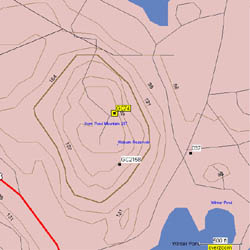
The Topo map shows elevation lines useful during hilltop ascents. It also showed the old unpaved access roads. Streams and lake shorelines are better defined.
Note that the abandoned reservoir near the summit is not shown.
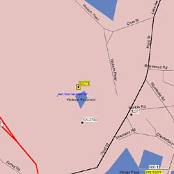
The Roads and Recreation maps are more useful when driving to the cache, since all roads are identified by name.
Both map sets can be loaded into the GPS. Turning off the R&R map reveals the Topo beneath.
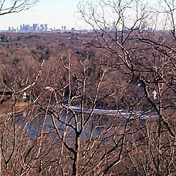
Downtown Boston is visible to the south.
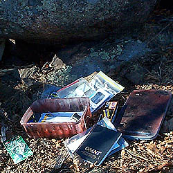
Took an interesting looking fishing lure that I'll try out this summer. Left a container of coins and a refrigerator magnet.